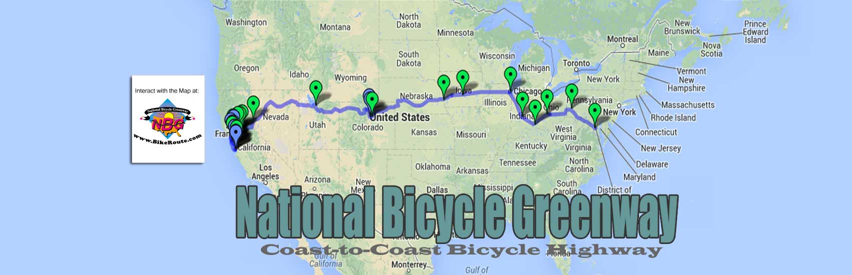

From Reno City Hall, we rode along the Truckee River on a Car-Free bike path that changed in quality, back and forth, from very good to tolerable all the way across Reno and neighboring Sparks. It took us to Interstate 80. We had had to climb a long on-ramp to get on to the thundering freeway that had gotten louder and louder as we approached. Instead of feeling intimidated by all its noise and fury like I had been in 2009 when I last rode this stretch, I felt confident and purposeful as I took my place on the shoulder.
Following my example, everyone else got in single file behind me. On our left was 80-mile hour traffic. To our immediate right, at the other edge of the six-foot wide rubble covered shoulder was the hard steel barricade I had gotten pretty familiar with when I brought the Eagle out here last time. It was then, that several times a day, I would make use of the pilings that held up the metal barrier as a perch upon which I could brace myself for a stop. In such a way, I could take a short rest break or adjust something on my person or bike that needed two hands.
Instead of the more then 400 miles of this road I had had to endure in 2009, we only needed 35 to get to Fernley. It was from there that we would turn off of I-80 and make our way to Fallon where we would be reunited with Hwy. 50.
The Fernley we saw looked like it was made up of a new town and an old one. 8,400 people strong, the new Fernley seems to be built around a Walmart at the more eastern of its two freeway entrances. This as the more quaint and quiet Fernley, closer to Reno, and farther from the freeway, was almost a throw back to some of the peaceful towns we would find ahead on Hwy. 50.
From Fernley, we headed east to Fallon, 27 miles away. From there, the “Loneliest Road” began. Fortunately for us, we knew from some of the rides our NBG Scouts had done for us that America’s supposedly “Loneliest Road” was only lonely for car drivers and those cyclists who did not like the open road. With towns separated from one another by an average of 70 miles, most of the automobiles on the road would be those out for the long haul and not those busy scurrying back and forth from one nearby population center to the next. And since Interstate 80 had long ago bypassed Hwy. 50 as the preferred way for those in motor vehicles to get across Nevada, we also knew that most who used this road would not be in a hurry.
The local Chambers of Commerce knew how to use their isolation to advantage. In response to “Life Magazine” in 1986 calling the highway that keeps them connected to the rest of the world ‘America’s Loneliest Road’, they began to circulate T-Shirts and a “Survival Guidebook”. The pamphlet they have created even tells road users how to find the “Loneliest Golf Course” and the “Loneliest Phone” (solar-powered no less). Even the Nevada Legislature has gotten into the act. They have officially designated this section of Hwy. 50 as the “Loneliest Road in America”.
 In terms of the physical challenge of this stretch of US 50, we knew a lot of the wonder at hand would make up for it. Even though there were lots of mountain passes, 17 of them, some as high as 7,000 feet, the views of the huge wide-open valleys with low sagebrush would be almost constant. We also knew we were up to the challenge. Having just successfully powered our way up and over the Sierras, we knew we were prepared for the nearly 30,000 feet of climbing over the next 400 miles that this part of our ride would present to us.
Nor would we have escaped a lot of climbing had we stayed on I-80. As the most mountainous state in the Union, Nevada has more than 300 named mountain ranges, all running north south as part of the Great Basin complex. In what is the Nation’s 7th largest state in terms of landmass, there are 172 mountain summits over 2000 feet. And it is interesting to note that the federal government owns most of Nevada, over 85 percent of this mostly brown, mostly rolling real estate.
The lands around us grew more and more desolate as we moved toward Fallon, an agricultural and retirement community of 8,500 that also housed a Navy base. From Fallon on, as the road switched from four lanes to two, for miles all we could see was sagebrush never more than a few feet tall. This as barren, brown-colored mountains always seemed to frame the sun burnt plant life whose growth had been stunted by the harsh conditions that now fully enveloped us.
About 50 miles past Fallon, the sameness of scenery was interrupted by the town of Middlegate. The small hand-made, crudely hand-lettered sign that announced it read:

Built in 1857, Middlegate is a former Overland Stagecoach stop on the fabled Pony Express route through the Nevada desert. Set in a clump of shade trees, an anomaly out here, Middlegate was one building. Its roof was covered in corrugated tin. Called “The Bar” it served as a bar, grocery store, restaurant, gas station and an office for the several cabins and RV hookups for rent.
Inside there was a telephone booth in the middle and a random selection of junk and pieces of art all hanging from the walls. The chef made us a tasty veggie burger, though we could have opted for the one-pound Monster Burger. Had we been meat eaters, and gotten one all down, we would have received a free T-shirt that read. “I Ate the Monster, in Middlegate, NV” complete with a large image of the burger itself.
The Loneliest Road still roughly follows the original Lincoln Highway route through here. Its relative lack of services when compared to most American highways serves to remind the cyclist that motorists also once had to be able to go long distances without being able to purchase food, cold drink and shelter.

Austin
After Middlegate, we rode hard for 64 more miles of up and down sagebrush lands before we came upon a Ghost Town. In 1862, silver was discovered in it. And for the next ten years, people flooded into what became known as Austin, Nevada. So much so that Austin now a remnant of its former self at 270 residents, once boasted 10,000 people.
It wasn’t long before a lumber mill had been built and four hundred homes had been constructed. There were schools, churches, hotels, stores and, in keeping with the Wild West, the required number of saloons and pleasure houses. The first newspaper arrived in 1863 in the form of the
. It is still being printed today and claims to be the oldest continuously published newspaper in Nevada.

Eureka
To get to the next town, we would have to pedal over two mountain ranges with three passes, one Austin Summit that reached 7,484 feet. As I worked to get to the former boomtown of Eureka, I had a fair idea of what to expect. This was so because its present residents had done a lot to preserve its rich history.
Like Austin, silver was also discovered in Eureka. However, since Eureka’s silver contained high amounts of lead, it wasn’t until 1869 that the smelters it put into action, helped it overtake Austin in terms of production. So much so, in fact, that by the time the last of its mines closed down in 1891, Eureka produced more than four times the wealth that Austin did. During this time, Eureka was also referred to as the “Pittsburgh of the West” because of the heavy smoke belching out of as many as 16 different smelters.
In 1878, Eureka reached its peak in population of about 9,000 people. It was a bustling city with dozens of saloons and gambling houses, There were also several opera houses, two breweries, five volunteer firefighting companies and an assortment of doctors, merchants, bankers and other business people.
As the city’s economy shrank with the closing of the mines, many of the local businesses and residences were acquired and maintained by the families (many of whom had come out of poverty in Europe) who stayed. The 435 people who live there now maintain the small handful of shops and stores in the heart of town as well as the four or five lodging purveyors that accommodate over night visitors.
There are also a few jobs at the local high school, which was rebuilt in 1924. In 1887 it graduated six people. The elementary school, which came much later, joins a working courthouse to employ a few more locals. Two-stories tall and made of brick, the house of justice was completed in 1880.
Everyone had caught up with me well before we got there, but by the time we did reach Eureka, we were all desperate for something cold to drink. We stopped at a business with a bright red sign that must have been 40 or 50 feet long across the top that in white letters read, “Casino Restaurant”. A regionally famous eating establishment and bar, it was called The Owl Club. We found out from talking with the bartender, it began life in the 1870’s as a brewery.
He also filled us in on some other things about Eureka. We had spotted a couple of cemeteries on the way into town and were told there are at least five of them. We also saw a few small churches and heard that a few of them still had active congregations.
Eureka is also proud of the Opera House we had seen that looked more like a saloon than a venue supporting the arts or matters intellectual. The Owl man told us it had been renovated in the 1990’s. Built to be fire proof in 1880, it has an iron and brick front and its two-story walls are two feet thick. During the hey-day of Eureka, famous personalities had supposedly performed there. Today it is used as a cultural and arts center, a community auditorium and a full-service convention center.
My bedtime was early. And once again, morning came too soon. A full day of up and down climbing and descending ensued. Seventy-seven miles worth, it was good that I got a lot of them in before 10AM because by the time morning had passed; the heat was at its fullest strength. It wasn’t long before all the water I found myself drinking was warm. Soon, my own perspiration was the only thing that kept me cool as the slight breeze passing over my skin helped to keep me from overheating.

Ely
At the 77-mile mark, Ely was a welcome end to a very physical day. As we entered town, the road widened to four lanes. About half way through it, right on Hwy. 50, we found a Mexican restaurant that looked more like a house than a business. The air conditioning it boasted of frightened us.
“When a car passes us out there, that is what they take for granted,” Skot called. “Man they got the a/c on and they think they are toughing it out because they have to sit and stare for few hours.”
We all agreed.
The food was great. And the chance to relax out of the sun, in a cool room, felt like heaven. We had a hard time leaving.
With a little over 4,000 people, Ely is bigger than Austin and Eureka combined. And yet instead of silver, its fortunes once had been staked on copper. But it took Ely a while to realize this. I knew this and more because once again, I had done my homework before we arrived.
Ely was first established in the 1870’s as a stagecoach station and post office. Only after it was designated the White Pine County seat in 1887 did its population climb to 200. When copper strikes began to crop up all around it, in 1906 the Nevada Northern Railway completed a station in Ely to service the mines that had resulted. By the end of that year nearly 5,000 people were all packed into Ely.
The two steam trains that moved the produce of the mines remained in service until 1941. Forty-five years later, in 1986, the trains, cars and infrastructure were restored so well that in acknowledging them as a National Historic Landmark, they were referred to as “the best-preserved, least altered, and most complete main yard complex remaining from the steam railroad era.” Now known as the Ghost Train, it is this line that takes tourists on a history-laden tour through 150 miles worth of track.
In Ely’s quaint downtown, we also couldn’t miss the Hotel Nevada. Built in 1929, at six stories, it was once the tallest building in the state. It is now a thriving casino and hotel.
Ely, Nevada was the end of the road for America’s “Loneliest Road”. At its Visitor Center, we found a poem that seemed to bring the history of the lands through which we had passed into the context of the harried pace within which most of us live our lives. I took a picture of it with my iPhone.
Before we left Ely, after having had our “Survival Kit” map stamped in the towns of Fallon, Austin, Eureka and Ely, we found a mailbox for the postage-paid form that it comes with. By the time our journey to Washington, DC was complete, we would return home to a survival certificate signed by the Governor of Nevada, a Route 50 lapel pin, and a bumper sticker announcing that we had survived an “uninteresting and empty” road.
Even though for much of the Loneliest Road, a rumble strip fills most of the tiny shoulder, there were so few cars that this was not a problem. A beautiful and peaceful ride, even the temperature cooperated for the most part. Nowhere near as hot as the deserts to the south, we had found ourselves biking through 80 and low 90-degree heat.
Nor was water endangered to the point of emergency. The longest gap between it was the 77 miles that stood between Eureka and Ely. In terms of life between towns, the occasional car was not the only sign of it. From time to time, we spotted bands of sheep with their herders and working sheepdogs. We saw a few small bands of wild horses, a few antelope, and even watched a deer dozing in the shade of one of the few trees that can withstand these conditions, a pinyon pine tree.
We found out later that the nuts from inside the pinyon pine cones served as a source of food for area wildlife. A tree that grows best at 7,000 feet, its nutmeat was also enjoyed by the 500 people in the Shoshone Indian reservation near Ely.
Apparently the word about Hwy. 50 had gotten to other cyclists. Upon talking to some of the locals along the way, we found out that they saw about half a dozen touring cyclists per week.
Over the next four days and 250 or so miles, the long up and down mountain passes were far from done as we biked from Ely to Salt Lake City. In fact with 63 miles to go before we left Nevada for good, we ascended the highest pass we would come across in Nevada, Connors Pass, at 7,733 feet. There was also 150 miles of desert left to cross. It wasn’t until we hit Delta, UT, that humans appeared to be in control of the lands through which we were rolling.
From just beyond Delta, the climbing finally gave way to the rolling terrain that housed the former mining centers of Silver City, Mammoth, Tintic and Utah’s version of Eureka. The last ten miles to Payson, where we stayed our last night before we stopped in downtown Salt Lake City were all downhill!! From Payson on, with the incidence of driveways and intersections and cars increasing, Salt Lake City seemed to have begun. For the next 60 miles, it was hard to tell one city, Provo, Orem, Lindon, Pleasant Grove and American Fork, from another on our way in to the big town.
You must be logged in to post a comment.